
Morrisville Borough officials announced that FEMA confirmed the municipality met the standards required to reduce flooding hazards in the borough which will enable property owners to purchase and submit flood-related claims for insurance claims.
The levee accreditation project was initiated in 2017, aimed at restoring FEMA’s accreditation after its removal following flooding from Hurricane Katrina.
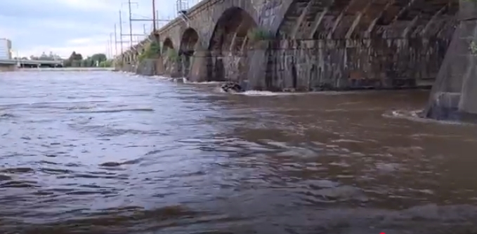
Flooding has plagued the municipality for decades. A levee/dike was built in the 1930s to protect the borough’s lowlands from catastrophic Delaware River flooding, historical experts noted in state and county records.

The Morrisville Levee recertification involved extensive surveys, geotechnical studies, and hydraulic analyses, local and federal officials said.
Recertification is required to confirm the levee’s ability to withstand severe flooding, officials said.
While approximately 90% of the 101 properties behind the levee will be excluded from the FEMA flood zone, a few homes near the loop of Park and Central will remain, the study said.
Residents behind the levee should monitor FEMA’s updated flood maps once they are released officials recommend.
If a property is removed from the flood zone, they can contact their insurance and mortgage companies to request adjustments to their policies. While flood insurance is no longer mandatory for properties removed from the flood zone, residents may still purchase it voluntarily for added protection, said Borough Engineer Kurt Schroeder of Gilmore and Associates.
For the small number of homes still within the flood zone, particularly near the ends of the island where Park and Central. These properties remain at low elevations and are impacted by runoff from the canal, which bypasses the levee through a wastegate, officials said.
Borough engineers said, that in order to address this, plans are underway to collaborate with Department of Conservation and Natural Resources (DCNR) to block the wastegate and construct an additional spillway north of the Calhoun Street Bridge. This spillway will redirect excess canal water back to the river, preventing it from flowing behind the levee and into the basin area.
Once completed, these measures are expected to significantly reduce flooding, potentially eliminating it entirely within the flood map area behind the levee, Schroeder explained.
This improvement will also benefit properties near Park and Central Streets and parts of the park, Schroder said, ensuring future facilities/properties are not at risk of flood damage.
The Borough engineering firm, said improvements will only impact areas within the levee limits, specifically between the Calhoun Street and Bridge Street Bridges.
Officials said the upcoming spillway project north of the Calhoun Street Bridge will aim to further reduce flooding. This project, once completed, is expected to remove nearly all remaining properties from the flood zone. This will offer significant long-term benefits to residents and the borough.
Editor’s Note: Publisher Jeff Bohen contributed to this report.